Welcome to the bright coast!
The islands of the Bay of Bothnia are in many ways different to other coastal areas in Sweden. In tourism circles the area has been called “the bright coast”, a name it certainly deserves. From May to July the days here are very long due to the bright summer nights.
There is a lively around-the-clock birdlife in the area, and you can almost see the growth that is taking place around you. But the islands here are also bright during the wintertime. From November to May the region is covered by ice and snow, making the landscape bright and inviting. The Bay of Bothnia is thus more of an all-year-round destination than other coastal areas in Sweden.
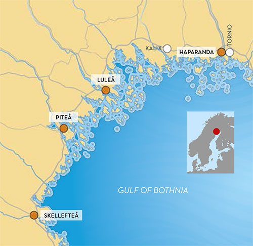
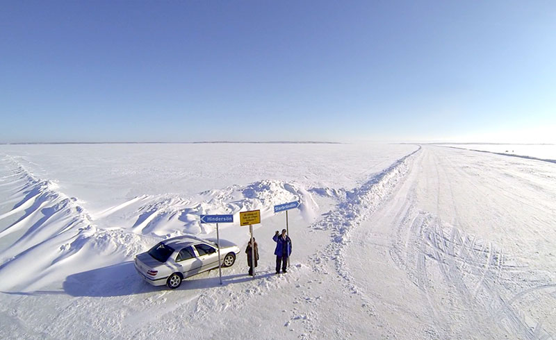
During the wintertime it is possible to get around with the help of ice skates, sled, skis and snowmobile, or to travel by car on the ice roads that are carefully monitored for safety purposes and that lead out to a number of the larger islands. The brackish water, land elevation and large water level fluctuations are other characteristics of the islands of the Bay of Bothnia.
The islands of the Bay of Bothnia are perhaps one of Sweden’s least well known coastal areas, but they are definitely one of the most exciting. The definition of an island is a landmass that is surrounded by water and is larger than 20 m². According to that definition, the Bay of Bothnia has 4,001 islands, distributed among the various local municipalities as follows:
- Islands of Haparanda: 652 islands
- Islands of Kalix: 792 islands
- Islands of Luleå: 1,312 islands
- Islands of Piteå: 550 islands
- Islands of Skellefteå: 695 islands
Brackish water
The many freshwater rivers in the north of Sweden mean that the Bay of Bothnia has brackish water with a low salinity level of only 0.2-0.3 %. This can be compared with the world’s oceans and Sweden’s west coast where the salinity level is around 3.5 %.
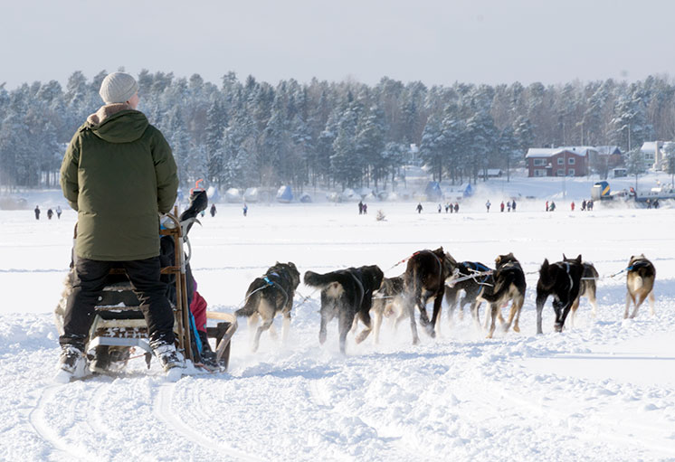
The brackish water means that the most salt-dependent sea species, such as the blue mussel and bladder wrack, do not inhabit the Bay of Bothnia. Instead, species such as the ringed seal, grey seal, cod, herring and salmon are found here, along with freshwater species such as the pike, whitefish and perch.
Seabirds such as the black guillemot, velvet scoter, oystercatcher and lesser black-backed gull inhabit the area, along with inland species such as the wood grouse and willow grouse. There are also many species of plant that feel at home in the brackish water. Local varieties of wormwood (Artemisia campestris ssp. bottnica), hair grass (Deschampsia bottnica) and eyebright (Euphrasia frigida var. baltica and Euphrasia bottnica) are some plants that only exist in the north of the Bay of Bothnia. Such plants, which have a very limited geographical distribution in the world, are known as endemic species.
A rising landscape
One thing that is highly characteristic of the islands of the Bay of Bothnia is the rising land elevation. 10,000 years ago the inland ice melted away, and the landscape was thus no longer subjected to its great weight. Having previously been pressed down by the ice, the earth’s crust now began to raise itself up. That process is still continuing today, to the extent of 80 cm every hundred years. Current measurements, however, indicate an increase in land elevation of only 60 cm per hundred years, due to the fact that the level of the sea is also rising on account of global warming.
The rise is land elevation is extremely noticeable to the coastal population, who now see their childhood jetties and boathouses ending up on dry land. Many islands in the region are still referred to as skerries or shallows, names they have retained from the time they first rose up from the sea, perhaps as long as a thousand years ago. And many former islands, for example Porsön and Hertsön, are stilled referred to as islands these days, even though they are now connected to the mainland.
High and low tide
Since the islands of Norrbotten (North Bothnia) are located at the very north of the Baltic Sea, the region is subject to very large water level variations. The difference between high and low tide can be as much as three metres. This is due to the fact that the water level rises during periods of strong southerly winds and low pressure, while it falls when northerly winds and high pressure drive the water to the south of the Baltic Sea. In this way the entire volume of water in the Baltic Sea can “swing” back and forth. As a consequence, beaches which are easy to get to during low tide can be totally submerged in water during high tide.
Islands that are alive
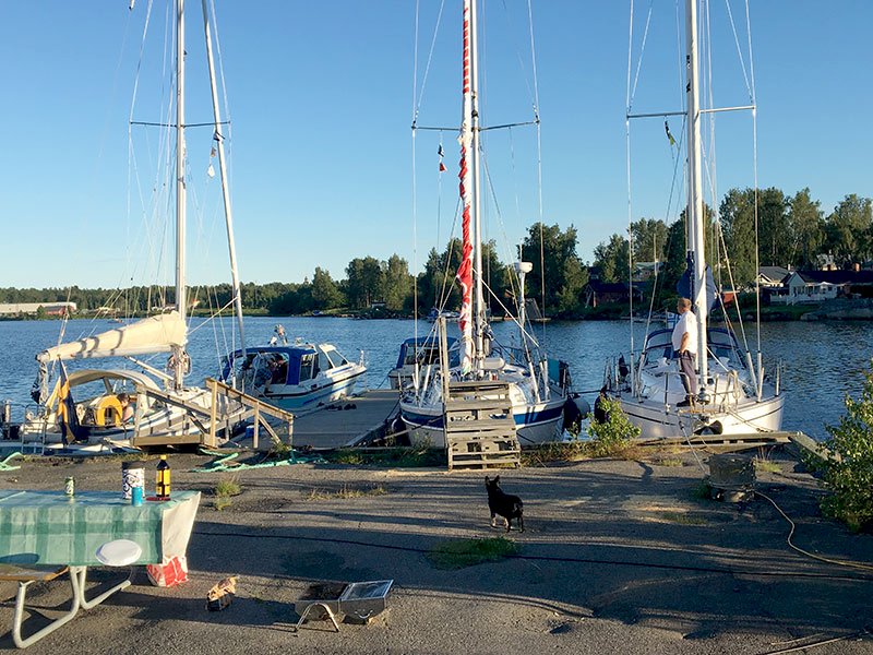
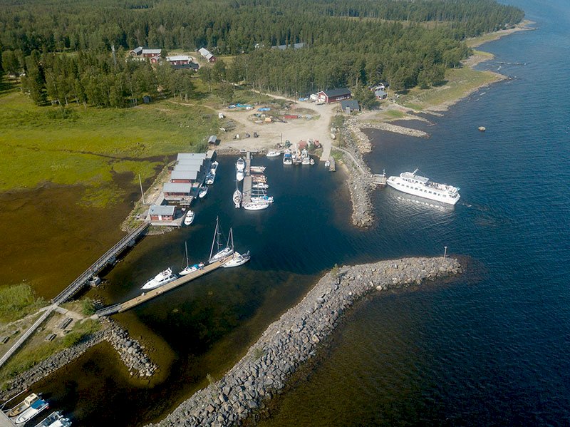
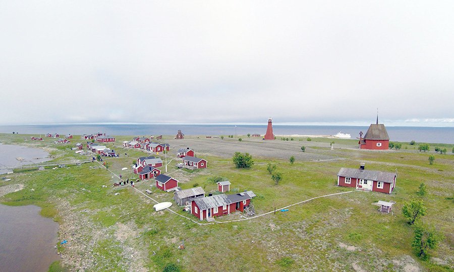
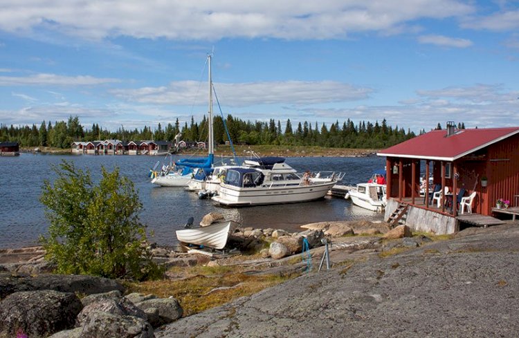
The islands of the Bay of Bothnia are alive, and not just in terms of the richness of their animal and plant life. A number of the larger islands have a resident population, and on many islands there are fishing villages that are used by the mainland population. Fishing and seal hunting have always been important sources of income for the coastal people. That is why it is possible to find many older, exciting settings with fishermen’s cottages, boathouses and jetties that bear witness to the lifestyles of the people in the region.
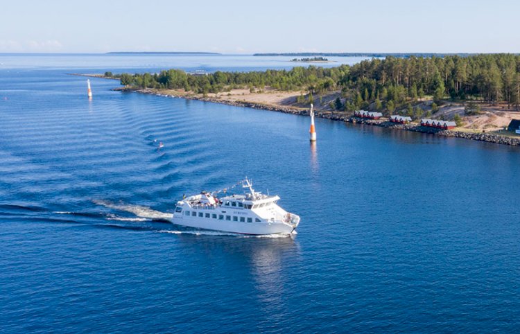
If you are lucky you will run into people who can tell you stories about the fishing and journeys on water and ice during the olden times. These days the islands are more accessible to visitors than ever before. Tour boats during the summer, and ploughed ice roads during the winter, make it easy for anyone to get to the region’s many treasures. There are also places where one can eat a meal or stay overnight.
Plants on the beaches of the islands of the Bay of Bothnia
There are many different types of beaches – rocky beaches, beaches with large boulders, sandy beaches and muddy beaches. A beach meadow has different plants than a shingle beach or a smooth rock face. On certain beaches we can find the natural habitats for many meadow plants. The sea ice planes away the shrubs and trees, and the result is an environment that is open and bright with less competition, a situation in which meadow plants thrive.
Since the land rises out of the sea, the plants appear in different “zones” according to how quickly they migrate. Outside the coniferous forest there is a belt of birch, followed by grey alder and then lower shrubs such as willow, myrtle and buckthorn. At high tide the water can reach all the way up to the alder forest.
The area next to the shrubs is much enjoyed by high-growing herbs such as valerian, meadowsweet and, on occasions, the stately angelica plant. After that there are a number of grasses and sedges. Dense carpets of reed grass are formed, and you can also find purple moor grass and creeping bent.
Furthest out in the water we have the yellow hair grass (Deschampsia bottnica), which is endemic to the islands of the Bay of Bothnia (in other words it is only to be found within a very limited geographical area). Lyme grass is the variety of grass most often found on sandy land, along with the purple-flowering beach pea herb.
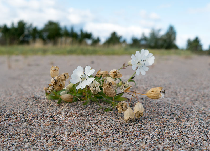
On the beaches of the Bay of Bothnia it is also common to find a range of grasses, sedges and rushes such as spike-rush, sea arrow-grass, Baltic rush, saltmarsh rush, water sedge and small-fruited yellow sedge. The beaches are also home to some very beautiful flowers, such as the biting stonecrop, marsh pea, field sow-thistle, grass of Parnassus, purple loosestrife and sea campion.
And don’t forget to keep an eye out for some of the region’s small but beautiful treasures: the pink-flowering sea milkwort, the white-flowering sea sandwort, and the sea plantain with its beautiful yellow stamen. Other plants that are endemic to the Bay of Bothnia, apart from the aforementioned yellow hair grass (Deschampsia bottnica), are the local varieties of wormwood (Artemisia campestris ssp. bottnica) and eyebright (Euphrasia frigida var. baltica and Euphrasia bottnica). These endemic varieties are the sorts of plants in which botanists are particularly interested.
The yellow Greenland silverweed and the beautiful, pink Siberian primrose are two genuine northern arctic species that can be found in the region and that bear witness to the Bay of Bothnia’s arctic qualities.
Animals of the Bay of Bothnia
Seals are probably the animals most often associated with the Bay of Bothnia. You are lucky if you get to see any seals during the summertime and, if you do, it will most likely be from a boat. The islands of the Bay of Bothnia are home to two species of seal – the large grey seal and the smaller ringed seal.
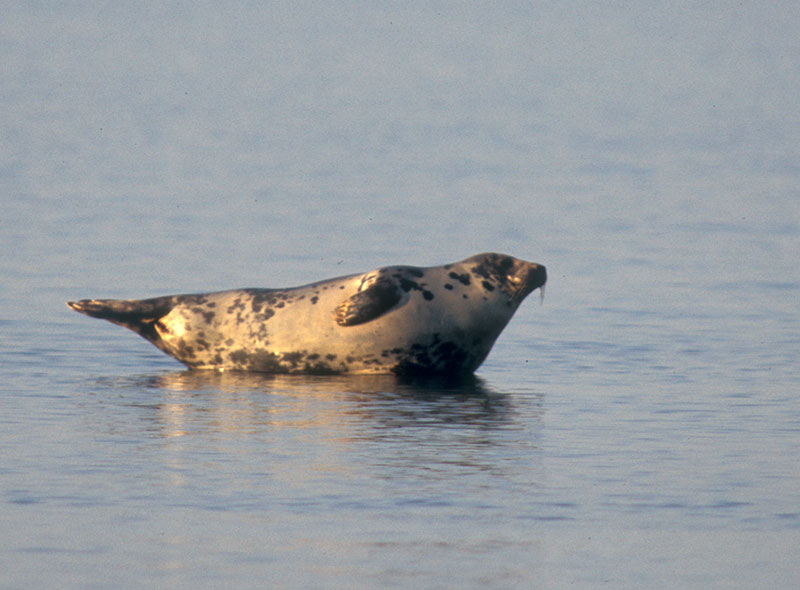
The ringed seal is really an arctic species that has been “trapped” in the Bay of Bothnia since the ice age. It displays its love for ice during November and December, when large flocks of ringed seals go in search of the first ice around the inner islands, and are more than happy to creep up onto the edge of the ice for a rest. The ringed seal lives through the winter in the pack ice and also gives birth to its pups there, while the grey seal heads south during the winter in order to get away from the fast ice.
Although the islands have the same fauna as the mainland, with moose, hare, wood grouse, black grouse and ptarmigan, they are also home to an array of genuine sea species, such as the ruddy turnstone, black guillemot and lesser black-backed gull. Strangely enough, there are many species that we find on the coast – and in the mountains! Examples include the redshank, the Temminck’s stint, the velvet scoter, the common scoter, the Arctic tern and the sea eagle.
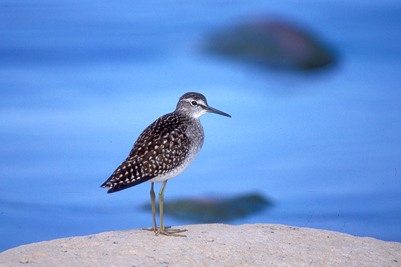
Some of the birds that are commonly found along the coastline include the red-breasted merganser, which often fishes very close to the shore, the common sandpiper, which flies tootling over the surface of the water, and the white wagtail, which runs onto the shore and captures bugs.
In marine environments, many birds nest in densely populated colonies. This provides them with good protection against predators. Here in the Bay of Bothnia there are many newly arisen skerries with densely populated nesting colonies of black guillemot, lesser black-backed gull, seagull, black-headed gull, little gull or Arctic tern. A colony can often consist of several species. Ducks and geese like to try to join the colonies and thus derive the benefit of the protection provided by the gulls.
Thomas Öberg / Natur i Norr (Nature in the North)
The history of the islands of the Bay of Bothnia
Historically the province covered the Bay of Bothnia’s west coast all the way up to the Kemijoki River, which formed the boundary to Ostrobothnia. Once Finland had become an autonomous Grand Duchy in the Russian Empire in 1809, this part came to be counted as part of Finnish Lapland over time. In 1810 the province of Norrbotten was formed, and since then the northern part of the old province has developed into a province of its own, Norrbotten.
Västerbotten was originally a province in Sweden (as it appeared at that time) which stretched out on the western side of the Bay of Bothnia. After the dividing up of Sweden in accordance with the Treaty of Fredrikshamn in 1809, part of the province of Västerbotten ended up on the Finnish side of the border. At a later stage, Västerbotten on the Swedish side was divided up into Västerbotten and Norrbotten.
The boundary between the historical province of Västerbotten and Ostrobothnia was formed by the divide between the Torne River and the Kemijoki River, while the new national boundary (which still applies to this day) was designated as the Torne River. Västerbotten in Finland is, so to speak, the east bank of the Torne River.
Västerbotten
Roughly measured, the coastline from Juvikklubben in the south to Grubbholmen in the north is over 400 km long. The close proximity to the sea creates a lower air temperature during late spring and summer, but a higher temperature during autumn. The water in the more protected sea bays begins to freeze in November. The coast is also characterised by large variations in its water level, which is affected by prevailing air pressure, wind direction and, to some extent, the flow of water from the adjacent rivers.
Along the coast, many of the birds also move as they make their way to their nesting places in the north. At Bjuröklubb and Grundskatan there are excellent possibilities to see thousands of birds pass by at the end of April/beginning of May.
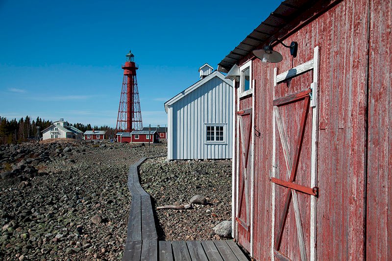
In the late autumn there are excellent opportunities to see two species of seal, the grey seal and the ringed seal, along the entire coast. Travelling by sea has always been important, but far from risk-free. Despite treacherous shallows it was considered safer to travel close to the coast than out on the open sea. The first four lighthouses were constructed during the 19th century, and the maritime pilot system was expanded and became a matter of government responsibility. At Pite-Rönnskär it is possible to visit Sweden’s second highest lighthouse. The path up to the top of the lighthouse at a height of 39 metres consists of 156 steps, and you will be feeling your thighs by the time you reach the top! The view out over the sea does, however, make the effort well worthwhile.
Skellefteå’s more than 400 km long coastline, with all its islands, islets and skerries, can be seen to be our largest recreational area, with endless possibilities for sunbathing and swimming, fantastic boat tours, exciting fishing, encounters with birds and seals, and so on. The well-used cliché “endless possibilities” is, in fact, not an exaggeration in this context.
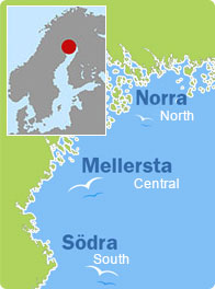
Norrbotten
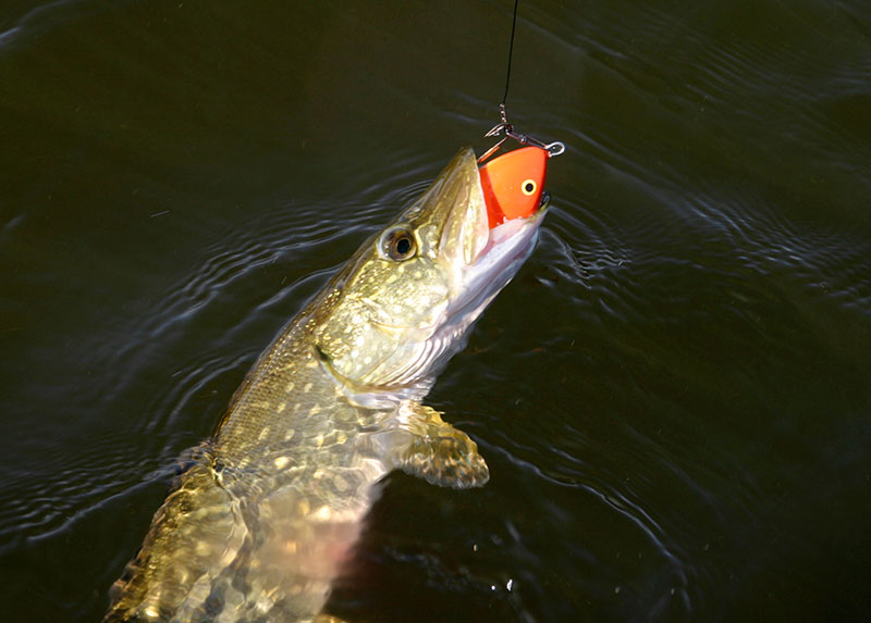
The islands of the Bay of Bothnia and the Baltic Sea are unique. They are the only collection of islands of any reasonable size that exists in brackish water. The islands of Norrbotten have a special status, due not only to their northern location, but also to their structure of low and flat islands. A number of the islands are barren and sandy. Sometimes the sand, influenced by the wind, has formed beautiful dunes. You can even find forest-covered islands of moraine, as well as islands consisting entirely of rocky outcrops. Perhaps the most characteristic feature of the islands of Norrbotten is the shallow and rocky beaches that are constantly rising up from out of the sea at a rate of not less than 1 m every 100 years.
Nature is of inestimable value when it comes to our need for recreation. We search for relaxation, far away from our stressful urban environments, in the beautiful and peaceful areas of nature. We now have more time for recreation than we did in the past, and our standard of living is higher, which has resulted in, among other things, more leisure boats and thus more opportunities for people to take in the islands in their free time.
The islands are filled with fantastic spots that the uninitiated might easily miss. It could be interesting scenery, fascinating relics, protected natural harbours, or places that provide an opportunity to stock up on food, water and fuel.
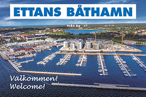
Don’t forget to visit Töre Harbour and the buoy there. If you leave your name and address there, you will receive a certificate from the municipality of Kalix to show that you have visited the northernmost harbour in the Bay of Bothnia.
Your journey then continues among islands full of interesting experiences, until you finally arrive in Hanhinkari – the last location before you are in Finland.
Finland
Travelling along the coast is a fabulous experience, with many small treasures just waiting to be discovered along the way. But above all else it is difficult to navigate, and here it is important to follow the nautical charts and not to come up with routes of your own. Why? Well, in Finland there is a large number of fixed fishing nets set out along the coast, and if you are unlucky enough to run into such a net then you will encounter bigger problems than you can imagine. But the region is also very rocky and shallow.
If you are travelling during the latter part of July until early August, you will get to experience many adventures along the way – the Pekka Days in Raahe, Wine Week in Oulu and, by no means least, the six boat clubs’ annual summer party at Il-Röyttä, an old shipping port outside Oulu. Hopefully at least some of these activities will whet your appetite for even more adventure.