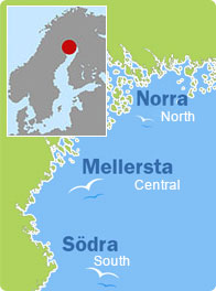
Seskarö, Haparanda (North)
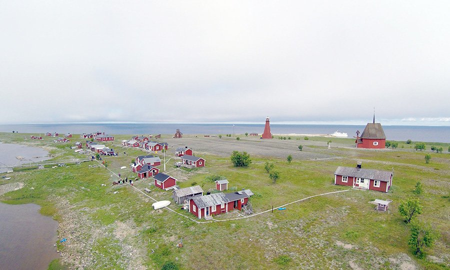
Seskarö (Seittenkaari in Finnish) is an urban area in the municipality of Haparanda, as well as an island about 20 km2 in size located among the islands of Haparanda.
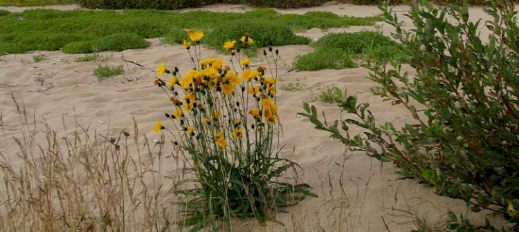
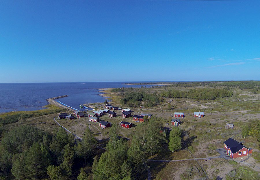
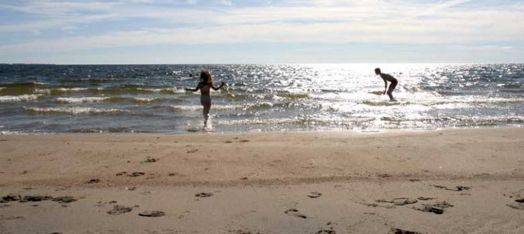
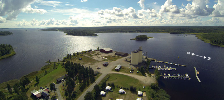
The island’s flora consists mostly of pine downland, although there are also areas with spruce and deciduous forest. The island has nice beaches suitable for swimming, especially on the southern side of the island, although in the Räpilahti bay in the north-eastern "corner" of Seskarö there is also a sandy beach with a natural harbour that even allows larger boats to put to on the shore. In the north-western part of the island you will also find the Sammakkoviken bay with scenic sandy beaches. The camping site is in Tromsöviken, with caravan parking, cabins for rent and seaside bathing. Since 1978 there is a bridge linking the island to the mainland via a number of other islands in between. Approx. 540 people live on the island. The disused sawmill (it was closed in 2008) has been the lifeblood of the island since the 19th century. Among the businesses currently active on the island there is a small electronics manufacturer, a manufacturer of packaging products, a general store, a petrol station with a selection of food, and the Seskarö Wärdshus eatery.
Make sure to visit the lovely old church with its very unique cemetery – there are no lawns – although the sand is raked into patterns.
Below you will find some tips about some nice places that are well worth a visit:
SORTTISVIKEN/RÄPILAHTI
Facts
Excursion harbour
Nautical chart 411
Outhouse toilet, barbeque area
Anchoring
Description of the approach along with references to the nautical chart
The best way to get here is to travel NE past Koivoluotofjärden and then in through the narrow channel. Stay between the middle of the cape with the cabin and the little islet NE of the cape.
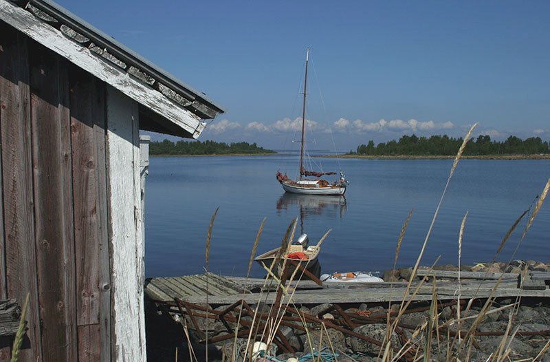
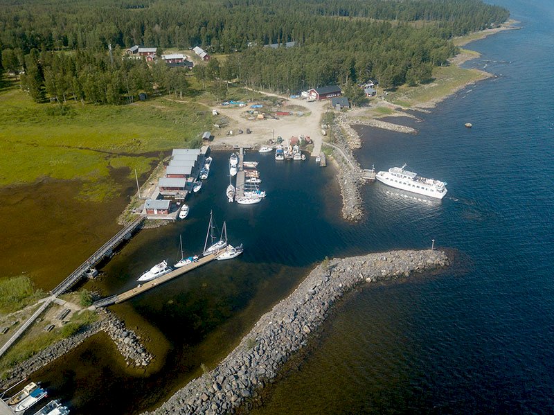
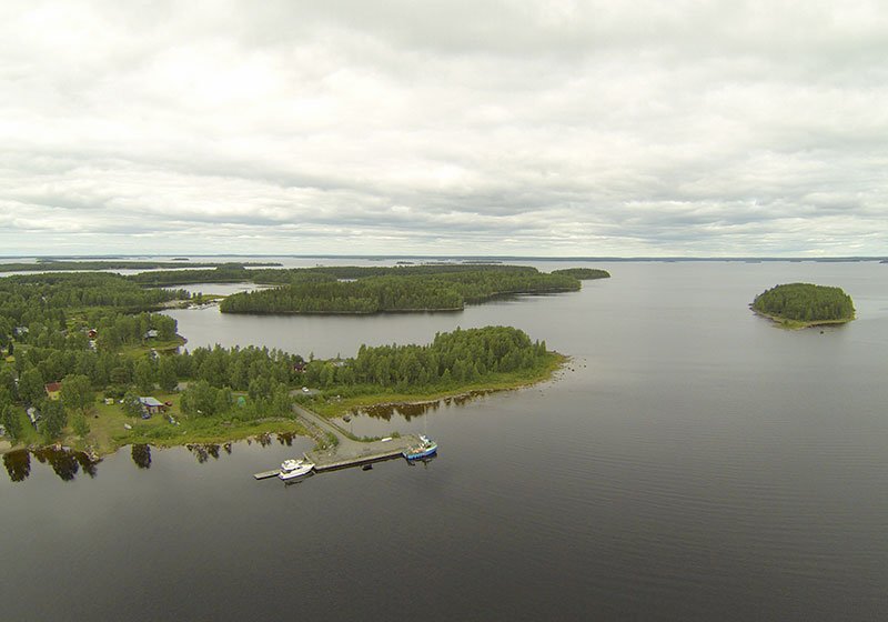
The natural harbour is located on the north-eastern side of the island. It provides shelter from all winds and has some nice swimming spots. Both smaller and larger boats can easily sail all the way up to the shore. There is an outhouse toilet here, as well as a barbeque area.
![]()
LEPPINIEMIKAJEN
Facts
Harbour depth: 4 m
No. of guest berths: 8
Nautical chart 411
The marking on the map shows LEPPINIEMIKAJEN
Description of the approach along with references to the nautical chart
You travel along the large waterway that passes north of Seskarö. You will pass a red buoy and then a green buoy with topmark – this is the waterway in to Sammakkoviken. Continue past it until you see a northern mark. Here you should turn to starboard and aim for the light beacon (2FR) on the mainland straight ahead. Keep to the leading line for about 0.6M and then set a new course 204o towards the quay.
When you have turned to starboard you can also aim for the inner bay and sail in to the boat harbour that is located at the head of the bay, position 65o 44´,50N 23o 44´,00E.
Stone quay and floating jetty. Anchoring for small to large sailboats. Within 1 km there is access to a grocery store, petrol station, telephone booth as well as everything else that the village has to offer. There is an outhouse toilet, but no other service. If you want to enjoy a hearty meal during your journey, the Seskarö Wärdshus eatery is less than 2 km away.
SAMMAKKOVIKEN
Facts
Excursion harbour
Nautical chart 411
Anchoring
Description of the approach along with references to the nautical chart
From the large waterway’s red buoy and the green buoy with topmark you set course 192o. Now you will come straight into the bay.
This is also a natural harbour on the north-eastern side of the island. Smaller boats to sailboats can easily put to in the bay. An ideal spot for swimming for the whole family, and also suitable for water skiing. No service available. If you fancy roaming around in the forest then this bay is a good alternative for a visit, providing good possibilities to explore Seskarö’s nature.
TROMSÖVIKEN
Facts
Excursion harbour
Nautical chart 411
Anchoring
Description of the approach along with references to the nautical chart
A nice lagoon on the island’s south-eastern side. The water is very shallow here, which is why you can’t put to at the shore, but instead must lie at anchor. If you have access to a dinghy, you can row to the shore and visit the service facility for the camping ground. Here you can buy provisions, and there is access to WC and a shower. Swim in the sun-drenched sea, and sunbathe on the warm sand.