Fairway description
Norra Kvarken and the Adjacent Swedish and Finnish Coasts
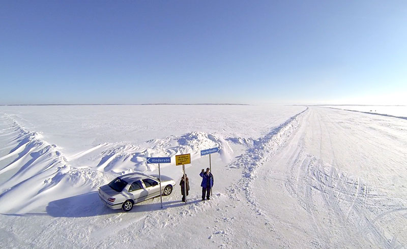
Norra Kvarken
The part of the gulf situated N of Norra Kvarken is known in Swedish as Bottenviken and in Finnish as Perameri.
8.19 Holmoarne (63°40'N., 20°52'E.), a group of islands and rocks, divides Norra Kvarken into two channels or passages.
Vastra Kvarken, on the W side, leads between the group and the dangers fronting the coast of Sweden; Ostra Kvarken, on the E side, leads between the group and the dangers fronting the coast of Finland.
8.19 Great care is necessary when navigating within both Vastra Kvarken or Ostra Kvarken, particularly during foggy weather, which is not infrequent. Mariners should bear in mind that the currents are uncertain and their movements sometimes precede the wind.
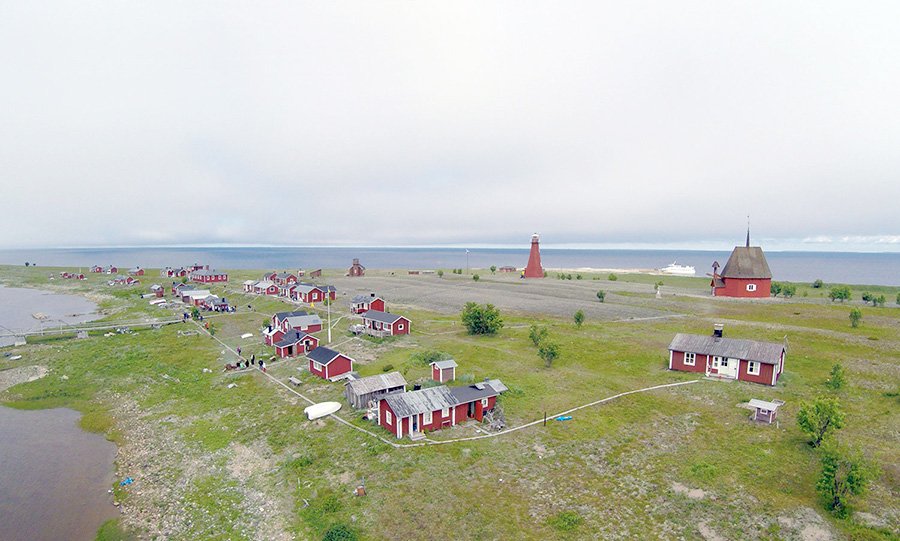
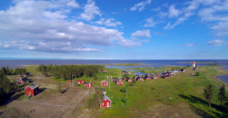
Holmon (63°47'N., 20°54'E.), the northernmost and largest island of the Holmoarne group, lies about 4 miles off the Swedish coast. The summit of this island is situated in the N part. It is 24m high and consists of a bare ridge surrounded by woods. Several houses, a lookout tower, and a church, with a high pointed tower, stand on this ridge and are prominent from seaward.
8.20 A chain of small islets, rocks, and shoals extends about 5 miles NE from the N end of the island and is marked at its outer edge by a buoy.
8.20 Byviken (63°48'N., 20°52'E.), a small harbor protected by breakwaters, lies within a narrow bay at the NW end of the island. It has a depth of 4m and is used by fishing vessels and pleasure craft. The bay is exposed to winds and heavy seas from the N and NE. Vessels with local knowledge can anchor, in a depth of 20m, sand, close off the W shore of the bay.
8.20 A conspicuous radio mast stands close E of Byviken.
8.20 Bergudden Light (63°47.5'N., 20°50.5'E.) is shown from a prominent wooden tower, 18m high, standing on the NW side of Holmon.
8.20 Lillhallansgrund (63°49'N., 20°52'E.), a shoal with a least depth of 5.9m, lies about 1 mile N of Byviken and is marked on its SW side by a buoy.
8.20 Falkgrund (63°51'N., 20°53'E.), a shoal with a least depth of 9.9m, lies 2.3 miles NNW of the N extremity of Holmon and is marked by a buoy. Shoal patches, with depths of 7.6m and 9.4m, lie about 0.6 mile ESE and 0.7 mile SSW of Falkgrund.
8.20 Stora Fjaderagg (63°48'N., 21°00'E.), a mostly barren island, lies 1.5 miles NE of the NE extremity of Holmon. A chapel, some fishing huts, and a beacon, 7m high, are situated on the S side of the island. A prominent tower, formerly a lighthouse, 13m high, stands on the summit of the island.
8.20 An extensive shoal bank fronts the N and E sides of Stora Fjaderagg. Lillgrund, an above-water rock, and Osterbadan, a shoal with a depth of 6.9m, lie about 1 mile N and 1 mile E, respectively, of the island.
8.20 Vessels can take anchorage, in depths of 9 to 16m, sand, about 0.3 mile S of the S end of Stora Fjaderagg. They must approach from the E and take care to avoid the reef extending up to about 1.5 miles from the E side of the island.
8.20 Angeson (63°44'N., 20°54'E.), low and wooded, lies close S of Holmon Island. Rocks and shoals extend up to about 1.8 seaward of the W side of this island and up to 4 miles seaward of the E side. These dangers are marked by buoys and may best be seen on the chart.
8.20 Grossgrunden (63°39'N., 20°51'E.), low and wooded, lies close S of Angeson and is fronted by shoals on each side. A
Bergudden Light
Stora Fjaderagg Tower
. Norra Kvarken and the Adjacent Swedish and Finnish Coasts beacon, with a radar reflector, stands on a group of abovewater rocks about 1.5 miles WSW of the N end of this island.
8.20 Jagaroren (63°41'N., 20°55'E.), a shoal, lies about 1.6 miles ENE of the N end of Grossgrunden. A disused light tower, 12m high, stands on this shoal and is equipped with a racon.
Holmogadd (Gadden) (63°36'N., 20°47'E.), the southernmost island of the group, is bare except for a few clusters of low trees and bushes. It is separated from the S end of Grossgrunden by Gaddstrommen. A conspicuous tower, 8m high, stands on the N part of the island.
8.21 A light is shown from a prominent granite tower, 20m high, standing on the S end of the island. Some dwellings are situated close to the light tower and a cain stands on the beach close S of them.
8.21 Gaddstrommen, a narrow passage leading between reefs, is the only navigable channel through the island group. It is marked by beacons and only used by small craft with local knowledge.
8.21 A rocky coastal bank extends about 2 miles S and 2.5 miles SE from the S end of Holmogadd. It is marked by buoys and may best be seen on the chart.
8.21 Huginsgrund (63°34'N., 20°46'E.), a shoal with a depth of 5.9m, lies 2 miles S of Holmogadd Light, at the edge of the bank, and is marked by a buoy.
8.21
8.2 A designated nature area, within which numerous restrictions apply, has been established around the E part of Holmon, most of Angeson, Grossgrunden, Holmogadd, and a large number of the adjacent skerries and rocks.
8.21 Due to the numerous off-lying dangers, vessels proceeding N in the gulf are advised to keep at least 4 miles from the E side of the Holmoarne group.
Nordvalen Light (63°32'N., 20°47'E.), equipped with a racon, is shown from a prominent floodlit tower, 26m high, standing 3.5 miles S of Holmogadd Light and 11 miles N of Utgrynnan Light.
8.22 A chain of rocks and shallow shoals extend up to about 7 miles S of Nordvalen Light. The outer shoals are marked by buoys and may best be seen on the chart.
8.22 Gerdasgrundet lies 1.5 miles SSW of Norvaken Light. This shoal has a least depth of 4.8m and is marked by a buoy.
8.22 Vastra Snipansgrundet, with a least depth of 2.3m, lies 6.2 miles SSW of Nordvalen Light. This shoal, which is the southeasternmost danger lying in the entrance to Ostra Kvarken, is marked by two buoys.
8.22 Odelgrund (63°25.5'N., 20°34.0'E.), with a depth of 11.9m, lies about 7 miles NW of Utgrynnan Light (63°21'N., 20°46'E.) and 8.5 miles SW of Nordvalen Light. This shoal lies at the outer edge of a bank extending SE from the vicinity of Gunvorsgrund Light (63°29'N., 20°27'E.) and is marked by a lighted buoy.
8.22 Waldersgrund, a detached shoal with a depth of 11.9m, lies about 1 mile ESE of Odelgrund and is marked by a buoy. Vastra Kvarken (63°42'N., 20°43'E.) is bordered on the W side by the dangers fronting the Swedish coast and on the E side by the Holmoarne group (see paragraph 8.20). This passage leads in a general NNE direction for 23 miles from a position 5 miles SE of Vaktaren Light (63°37'N., 20°25'E.) to the vicinity of Karingskar (63°54'N., 20°51'E.).
8.23 A coastal passage leads to the vicinity of Vaktaren Light (see paragraph 8.8).
8.23 The recommended route, which may best be seen on the chart, leads NNE using the white sector of Bergudden Light (63°47.5'N., 20°50.5'E.). When about 2 miles from the light tower, vessels should steer more to the N and adjust their course in order to pass WNW of the light and ESE of Tarngrunden (see paragraph 8.8).
8.23 The route then leads in a NNE direction and passes close WNW of Lillhallansgrund and Falkgrund. After passing Falkgrund, vessels should steer more to the NE and head for a position 2.3 miles ESE of Karingskar. They should then head NNE using the white sector of Bergudden Light, astern.
8.23 Vessels entering from the N should head in a SSW direction using the white sector of Bergudden Light. When about 7 miles from the light structure and E of Karingskar, they should head SW to pass close W of Falkgrund shoal. The route then leads SSW and passes close WNW of Lillhallansgrund and about 0.4 mile WNW of Bergudden Light. When about 1.5 miles SSW of the light, vessels should adjust course and steer in a SSW direction using the white sector of Bergudden Light, astern.
8.23 Holmogadd Light Norra Kvarken and the Adjacent Swedish and Finnish Coasts Vaktaren Light. All requests for pilotage through Vastra Kvarkenmust be made through the VTS station at Lulea
8.23
8.23 Buoys moored within Vastra Kvarken are sometimes displaced by drift ice in the early part of the navigation season, and may also be fouled by timber rafts.
8.23 An area, within which anchoring, fishing, and diving are prohibited, extends across Vastra Kvarken in the vicinity of Bergudden Light and may best be seen on the chart.
Ostra Kvarken (63°33'N., 20°51'E.), the main offshore passage in Norra Kvarken, is bordered on the NW side by the dangers fronting the S and E sides of the Holmoarne group and on the SE side by the dangers fronting the coast of Finland.
8.24 Depths—Limitations.—A Deep-Water Route, which is marked by buoys, has been established through Ostra Kvarken. It extends for about 8 miles SW and 7 miles ENE of Nordvalen Light (63°32'N., 20°47'E.) and has a least depth of 16.2m.
8.24 The recommended track passing through Ostra Kvarken is authorized for drafts up to 13m.
8.24 Directions—Vessels should proceed in a N direction up the gulf to a position located about 8 miles WNW of Norrskar Light (63°24'N., 20°36'E.). The recommended track then leads NE from this position to the S entrance of the Deep-Water Route. It passes about 6 miles SE of Sydostbrotten Light (63°21'N., 20°11'E.), close SE of Odelgrund (63°25.5'N., 20°34.0'E.), and close NW of Waldersgrund, using the white sector of Nordvalen Light (63°32'N., 20°47'E.).
8.24 From a position about 5 miles SW of Nordvalen Light, the recommended track (Deep-Water Route) leads in a NE direction to pass close WNW of the shoals lying SW of the light. It then rounds the light, at a distance between 0.2 mile and 0.6 mile, and leads ENE toward a position located 11.7 miles NNE of Valassaaret Light (63°25'N., 21°04'E.), using the white sector of Nordvalen Light, astern.
8.24 Vessels bound for Umea or intending to use the coastal route through Vastra Kvarken should depart the recommended track (Deep-Water Route) in a NW direction when about 2.5 miles SW of Nordvalen Light.
8.24
8.24 Care should be taken when approaching the S part of the passage as the Swedish side, being high, may tend to appear closer than the low Finnish side.
SWEDEN—EAST COAST—RATAN TO THE FINNISH BORDER
9.0 Plan.—This sector describes the E coast of Sweden up to the N part of the Gulf of Bothnia. The descriptive sequence is NNE rom Ratan to Ranefjarden, then E to the Finnish border.
General Remarks
The water in the N part of the Gulf of Bothnia is discolored and almost fresh because of the numerous rivers discharging into it.
The coast of Sweden between Ratan and Tomsvarten (64°58'N., 21°23'E.), about 67 miles NNE, is fronted by numerous islands, rocks, and shoals. Although soundings off this part of the coast are very irregular, vessels should remain in depths of not less than 50m to ensure that they stay a safe distance from all off-lying dangers.
9.1 Between Pitea (65°19'N., 21°29'E.) and the Finnish border, shoals lie as far as 20 miles seaward of the outermost islets. Consequently, when vessels are in the vicinity of these dangers, the coast will be visible only in very clear weather. The depths are irregular. In a few places soundings give good warning of approach to dangers. However, for the most part, the shoals are steep-to.
9.1 In thick weather, the greatest care should be taken when approaching the land. Off this coast, the water is very muddy, especially during and just after freshets in the rivers, making it impossible to detect dangers by discoloration.
9.1 Caution.—Parts of the coast and some areas off the coast are incompletely surveyed.
9.1 Special marks and buoys are occasionally placed temporarily on and off the coast, during the summer season, for the purpose of making surveys. Vessels are warned not to mistake these special marks for the navigational aids.
9.1 During the winter, many buoys in these waters are removed, while others may be damaged or break adrift.
Ratan to Skelleftehamn
Rata Storgrund (63°59'N., 21°07'E.), with a least depth of 2.7m, lies about 6 miles E of the mainland coast. This shoal area consists of rock and shingle, and is marked on its W side by a buoy. A light is shown from a prominent tower, 17m high, standing on the S and shallowest part of the shoal. Rickleagrunden, a group of shoals, lies centered about 5.5 miles N of Rata Storgrund Light. The group has a least depth of 2.9m and is marked by a buoy moored on its W side.
Rataskar Light (64°00'N., 20°54'E.) is shown from a tower on a building, 8m high, standing on the W side of a wooded island of the same name lying close off the coast, 5.5 miles W of Rata Storgrund Light.
9.2 Ratan Sodra Light is shown from a tower standing on the mainland 0.2 mile W of the S extremity of Rataskar.
Rataskar Light
Sweden—East Coast—Ratan to the Finnish Border
Ratan (64°24'N., 20°54'E.) is a small natural harbor situated on the mainland. It lies abreast the middle of the sound between the coast and the island of Rataskar, close E.
9.2 The harbor can be approached from the SSE or the NE via channels, which are available to vessels with drafts up to 2m. The main quay is 95m long and has a depth of 4.5m alongside.
9.2 It is reported that the harbor is no longer open to commercial shipping and is used only by recreational craft.
9.2 Rataskar Beacon, octagonal shaped with a high pointed roof, is conspicuous. The prominent yellow lookout tower of the former pilot station is situated close S of this beacon. A number of knobby mountain tops are visible in clear weather behind the beacon; however, at close range, these mountain tops are obscured by the coastal land.
9.2 A large white spot on Norrklubb, the N part of Rataskar, is conspicuous. It is painted on a cliff and partially obscured by bushes. Norrklubb Beacon, a round-topped cairn, 4m high, stands on the N extremity of Rataskar and is prominent.
9.2 Dodmanskar, an islet overgrown with brush, lies about 1 mile NNE of Norrklubb. A conspicuous large and dark rock, with a flat top, is located at the E side of this islet.
9.2 Soderklubb Beacon, a round-topped cairn, 4m high, stands on an islet lying close S of Rataskar.
9.2 Vessels with local knowledge can anchor in the N roadstead between the mainland and Norrklubb, the N part of Rataskar. This anchorage has depths of 10 to 13m, clay, but is exposed to N winds.
9.2 Anchorage may also be obtained in the harbor, between Rataskar and the mainland, in a depth of 4m, clay.
Rataskar Anchorage (64°02'N., 20°55'E.) lies about 2 miles NNE of Rataskar. It is the loading place for Dalkarlsa, which stands 3 miles NW. The roadstead has a depth of 7m, sand, and is suitable for vessels with drafts up to 5m. It is exposed to SE and E winds. The anchorage can be approached from the SE, but local knowledge is required.
9.3 Sikea (64°09'N., 20°59'E.), a very small natural harbor, is situated near the head of Sikeafjarden, about 10 miles N of Ratan. The fairway leading to the harbor passes N of Rickleagrunden and is authorized for vessels with drafts up to 4.6m. There is a pier, 93m long, with a depth of 3m alongside. The harbor is no longer open to commercial shipping and is only used by recreational craft.
9.3 Vannskaren Light (64°10'N., 21°08'E.) is shown from a tower, 11m high, standing on the outermost of a group of treeless islets situated about 4 miles E of Sikea.
Gumboda (64°14'N., 21°06'E.) is a small natural harbor situated within Gumbodafjarden, 3.5 miles NNW of Vannskaren Light. Approach channels lead from the S, passing W of Vannskaren Light, and from the E, passing N of the light. The S fairway is available to vessels with drafts up to 6.5m. The E fairway is available to vessels with drafts up to 4.9m. Local knowledge is required.
9.4 The harbor is closed to commercial shipping and used only by recreational craft. It is reported that tugs towing timber occasionally find refuge here.
9.4 Gumbodahamn affords anchorage to vessels with local knowledge inside Sparren, in depths of 6 to 10m, sand and clay. Vessels can also anchor, in depths of 16 to 24m, clay, about 0.2 mile W of Lilla Vannskar, which lies 0.6 mile WNW of Vannskaren Light.
9.4 Bodbergen, 58m high, stands 1 mile NNE of the head of Gumbodafjarden. This hill has two rocky summits, the westernmost of which is the higher and conspicuous from seaward.
9.4 Vardstuteberg and Markberget, 95m and 104m high, stand about 3 and 4 miles NE, respectively, of the head of Gumbodafjarden. Both of these rocky crests are conspicuous from seaward. Lovsele (64°18'N., 21°15'E.) is a loading place within Lovselefjarden, which is entered about 8 miles NNE of Vannskaren Light. Knavringen, with a least depth of 7.9m, lies about 2 miles S of Blekeudden, the E entrance point of the fjord. Kallan, a rock awash, lies close N of Knavringen. A main channel leads from S and passes W of Kallan. Local knowledge is required. The fairway is available to vessels with drafts up to 4.9m. There is a quay, 150m long, with a depth of 4.8m alongside, but only 50m of berthage along the central part is available.
9.5 The harbor is closed to commercial shipping and used only by recreational craft.
9.5 Anchorage can be obtained by vessels with local knowledge within the fjord, in depths of 5 to 8m, mud, but the roadstead is exposed from S.
9.5 Varberget is a bare, conspicuous summit, 46m high, rising close to the shore, 2.7 miles NE of the W entrance point. Storklubben, an islet, lies about 0.2 mile SSE of the W entrance point and can be easily recognized. Sorkallen (64°14'N., 21°28'E.), with a least depth of 6.2m, lies about 5 miles offshore, 10 miles NE of Vannskaren Light.
9.6 Trindkallen (64°16'N., 21°31'E.), with a least depth of 4.3m, lies about 2.5 miles NNE of Sorkallen. These shoals form the outermost dangers in this vicinity. Kallviken (64°20'N., 21°22'E.) a loading place, is entered 3.5 miles NE of Lovsele. The main approach route to the roadstead leads from S. Vessels can use the fairways passing either E of Kallviksklubben (64°18'N., 21°23'E.) or W of Laskar (64°18.2'N., 21°21.4'E.). The least depth in these entrance channels is 3.9m. The roadstead has depths of 3 to 4.5m, clay and sand. It is very confined and can only accommodate a few small vessels. Vessels can also anchor, in a depth of 9m, near the mouth of the fjord.
9.6 Viksberget (64°21'N., 21°22'E.), a narrow rocky ridge with two prominent summits, is 60m high.
9.6 Bredberget, 71m high, rises about 1 mile NNE of Viksberget. This prominent hill is steep on its N side but slopes to the S.
9.6 Oxberget, 33m high, is steep on its SW side and surmounted by a white cairn beacon. This hill stands on the E side of the entrance to Kallviken. Kallviksskar, an islet, lies close inshore on the W side of the entrance. It is also marked by a white cairn beacon. The coast between Kallviken and Bjuroklubb, 11 miles NNE, is wooded and fronted by numerous shoals, which extend up to 3 miles offshore in places.
Sweden—East Coast—Ratan to the Finnish Border 135
9.7 Blackkallen Light (64°20'N., 21°31'E.) is shown from a prominent tower, 13m high, standing on a rock fronted by shoals about 1.5 miles offshore, 3.5 miles ENE of Kallviken.
9.7 Grundskaten (64°26'N., 21°37'E.), the SE extremity of Bjuron, a wooded peninsula, is located 6.5 miles NNE of Blackkallen Light. This point is fronted by a reef, which extends 0.5 mile seaward and is marked by a buoy. Shoals with depths of less than 10m front the coast between the light and Grundskaten and extend up to about 3 miles offshore in places.
9.7 Bjuroklubb (64°29'N., 21°35'E.) is a steep point, 43m high, which forms the end of a narrow promontory extending 1.5 miles NNW from the N side of Bjuron. A light is shown from a prominent stone tower, 8m high, standing on the point, with a yellow house situated very near it. A light is also shown from a structure situated on the NE extremity of the point.
9.7 An area of shoals lies centered about 1.5 miles E of Bjuroklubb Light and is marked on its W side by a buoy.
9.7 Hokmarksberget, located 8 miles WSW of Bjuroklubb Light, consists of two hills, which lie in a N and S direction. The W side is steep and shows up well from seaward, especially when N of Bjuroklubb.
9.7 Kulberget, standing about 4 miles SW of the N extremity of Bjuroklubb, has several summits. The southwesternmost summit, 65m high, is the tallest and a prominent radio mast is situated 1 mile E of it.
Gardfjarden (64°28'N., 21°43'E.), an inlet, lies on the N side of Bjuron, about 0.7 mile SSW of Bjuroklubb Light. Vessels can anchor, in depths of 9 to 14m, clay and sand, within this inlet, but winds between N and NNE raise some sea.
9.8 The roadstead within the inlet can be approached through two channels. Local knowledge is required. An inshore fairway leading from SE passes between the E side of Bjuron and the off-lying shoals. Another fairway leads from NE. Vessels with drafts up to 6.8m can reach the anchorage.
9.8 Bjuroklubb Harbor, is situated at the SE end of Gardfjarden. There is a quay, 70m long, with depths of 5 to 6.2m alongside. The channel leading to the quay is available to vessels with drafts up to 4.8m.
9.8 Ice is an obstruction to navigation in this area from the end of November to the beginning of May.
9.8 Anchorage may also be obtained by vessels with local knowledge, in depths of 7 to 12m, clay and sand, within Brattasfjarden, an inlet lying close W of Gardfjarden. The fairway leading to this anchorage is available to vessels with drafts up to 6.1m.
9.8 Caution.—A magnetic anomaly is reported to exist off Bjuroklubb. Vanoren (64°32'N., 21°33'E.), the E extremity of a low wooded peninsula, lies on the N side of Gardfjarden, 2.5 miles NNW of Bjuroklubb Light. It is fronted on the NE side by shoals, which extend about 1 mile seaward and are marked by a buoy.
9.9 Skotgronnan (64°36'N., 21°30'E.), fronted by shoals, is a low, sandy island with a knoll on its SW end lying about 7.5 miles NNW of Bjuroklubb Light and 1.3 miles off the coast. A beacon, fitted with a radar reflector, stands near its N end.
9.9 Skelleftebukten (64°41'N., 21°15'E.), a bay 5 miles long, lies at the mouth of the Skelleftealv, the principal river along this part of the coast. It is encumbered by numerous islets, rocks, and shoals, which may best be seen on the chart.
9.9 The bay is entered between Korsoren, a small peninsula lying 3 miles W of Skotgonnan, and Skelleftenaset, a large peninsula located about 5 miles NNW.
9.9 Burea (64°37'N., 21°14'E.), a former small port, is situated in the SW part of Skelleftenbukten. A conspicuous church, with a red roof and black spire, stands in the town. The harbor is now only used by recreational craft.
Skelleftehamn (64°41'N., 21°14'E.) World Port Index No. 27080 Skelleftehamn (Skelleftea), a large industrial harbor, is situated on the N side of Skelleftebukten. This harbor is the port for Skelleftea, a town standing on the N bank of the river, 8 miles NW.
9.10 Ice.—The port is usually closed by ice from the beginning of December to the middle of May.
9.10 Tides—Currents.—Ordinary HW and LW are about 0.5m above and below mean water level, respectively. The water level usually rises in the autumn with SE and SW winds, and falls with prolonged N and NE winds. Lower water levels usually occur in the spring and early summer. The average annual maximum and minimum water levels deviate 0.6m from the mean level.
9.10 With the breaking up of ice in the spring, the outgoing river current runs strongly for about 4 to 6 weeks and may attain a velocity of 1.5 to 2 knots.
9.10 Depths—Limitations.—Most of the port facilities are situated on the shores of Kallholmsfjarden. This inlet lies between Nasdden, on the NE side, and a narrow peninsula formed by a line of connected former islands on the S side. The narrow peninsula projects 1.5 miles SE from the head of the bay and ends at Ronnskar.
9.10 The port may be approached from either E or SE through routes, which are shown on the chart. The approach from E, which is suitable for vessels with drafts up to 11m, is recommended, especially in poor visibility. The approach from SE can be used by vessels with drafts up to 7m.
9.10 The channel leading from E passes at least 1 mile clear of the fronting dangers. The channel leading from SE passes between Skotgronnan and the mainland.
Bjuroklubb Light
Sweden—East Coast—Ratan to the Finnish Border
9.10 The principal facilities at Skelleftehamn, on the N and W sides of Kallholmsfjarden, are described below:
1. The oil quay is 70m long and has a depth of 10.2m alongside. It can handle tankers up to 200m in length and
9.3m draft.
2. Siporexkajen, a cement berth, is 47m long and has a depth of 5.8m alongside. The channel leading to this berth is available to vessels with drafts up to 5.5m.
3. The general cargo quay is 375m long and has depths of 6.4 to 9m alongside. There are also two ro-ro berths with depths up to 9.3m alongside. Vessels up to 25,000 dwt, 160m in length, and 8.5m draft have been handled at this quay.
9.10 The principal facilities at Ronnskar, at the S end of Kallholmsfjarden, are described below:
1. North Quay is 580m long and provides five berths with depths of 5.7 to 13.4m alongside. Vessels up to 40,000 dwt, 200m in length, and 11m draft have been accommodated at this quay.
2. South Quay, a T-shaped pier with dolphins, provides a berth, 120m long, with a depth of 9m alongside.
9.10 The pier at Orviken has a berth, 75m long, with depths of 3.4 to 4.6m alongside. It is in poor condition and no longer used by commercial vessels.
9.10 Aspect.—Gasoren Light (64°40'N., 21°19'E.) is shown from a prominent tower, 13m high, standing about 0.8 mile E of Ronnskar. A prominent dwelling, with a red roof, is located near the light.
9.10 Sor-Olsgrundet Light, equipped with a racon, is shown from a structure, 12m high, standing about 1 mile S of Ronnskar.
9.10 Bureberget, a dark wooded hill, stands on the SW side of the bay, 4.5 miles SSW of Gasoren Light. It is 99m high and prominent from seaward. This hill slopes gradually on the S side and a radio mast, 32m high, is situated close SE of the summit.
9.10 Noppelberget rises 1.2 miles NNE of Skelleftea. This hill is bare, light gray, and rocky. It is 140m high and easily identified from the SE.
9.10 A conspicuous chimney, 145m high, and a prominent warehouse, 300m long, are situated on Ronnskar and may be seen from a considerable distance to seaward.
9.10 A conspicuous radio mast, 60m high, stands near Orviken about 3 miles W of Gasoren Light.
9.10 A church, a water tower, and a radio mast, which are all prominent, are situated at Skelleftehamn.
Skelleftehamn to Pitea
The coast between the entrance to Skelleftehamn and Nygran (65°01'N., 21°42'E.), about 22 miles NNE, is wellwooded and fronted by numerous small islands, islets, rocks, and shoals.
9.11 Kagnashallan Light (64°45'N., 21°18'E.) is shown from a structure standing on the E extremity of Kagnaset. Kagnaset is an area that appears from E as a chain of sloping hills, high to the S, but steeper at the N end.
9.11 Finnhallan (64°47'N., 21°15'E.), standing on the N side of Kagnaset, rises above the cliffs and is wooded. Two abovewater rocks lie at the foot of this prominent hill.
9.11 Armbagen (64°41'N., 21°26'E.), with a least depth of 8.5m, lies about 3 miles ENE of Gasoren Light and is marked by a buoy on the SE side. Villan, with a depth of 9.7m, lies about 1.7 miles N of Armbagen. Fordarvet, with a depth of 6m, lies about 4.5 miles Nof Armbagen. It lies 3.2 miles offshore at the E end of the foul ground fronting Kagnashallan Light and is marked by a buoy. Utiken, with a depth of 10m, lies 3.5 miles NNE of Fordarvet and about 6 miles offshore.
9.11 The above four shoals form the outermost dangers along this part of the coast. Numerous shoal patches lie inside of these dangers and may best be seen on the chart.
9.11 Kagefjarden (64°49'N., 21°07'E.), an inlet situated SW of Ostnaset, is entered 5 miles NW of Kagnashallan Light.
9.11 Bergskaret (64°48'N., 21°07'E.), a partly-wooded islet, lies on the S side of the entrance to Kagefjarden, 6 miles NW of Kagnashallan Light. A sector light, which indicates the entrance route, is shown from a tower, 7m high, standing on this islet.
Gasoren Light
Sweden—East Coast—Ratan to the Finnish Border 137
Kagehamn (Storkage) (64°50'N., 21°02'E.) (World Port Index No. 27090), a small port used for exporting timber, is situated on the S side of Kagefjarden.
9.12 Tides—Currents.—Strong S winds cause higher water levels and N winds cause lower water levels. The current in the entrance channel is not troublesome.
9.12 Ice.—The port is usually closed by ice from November to the middle of May.
9.12 Depths—Limitations.—Kagefjarden can be entered from the NE or ESE. A marina is situated at the former W quay at Kagehamm. The main E quay is 200m long and has a depth of 7.2m alongside. Two cross quays, 30m and 40m long, are situated at the ends of the main quay and have depths of 3.5 to 7.2m alongside. Vessels up to 8,000 dwt, 110m in length, and 6.7m draft can reach the harbor and berth alongside.
9.12 Pilotage.—Pilots are available from the station at Gasoren (Skelleftehamn) and must be ordered through VTS Lulea. Local knowledge is required.
9.12 Anchorage.—Vessels may anchor, in depths of 9 to 18m, clay, off the NW point of Bergskaret or, in depths of 16 to 24m, sand, close NE of the islet.
Romelson (64°53'N., 21°17'E.), lying 6.3 miles NE of Bergskaret Light, is a high wooded island of dark appearance. It is tallest in the center and drops off toward the N end. The land behind this island has several mountain hillocks.
9.13 Hamnskaret, a small islet, lies about 0.5 mile off the middle of the E side of Romelson. A few trees and a white hut with a black roof stand on this islet.
9.13 Utkiken, with a least depth of 10m, lies about 6 miles SE of Romelson and is the outermost shoal in this vicinity.
9.13 Furuogrund (64°55'N., 21°14'E.), a former timber-loading place, is situated 0.5 mile NW of Romelson. The small natural harbor is now only used by recreational craft. The channel leading to the harbor from SE is available to small craft with drafts up to 5.5m. Local knowledge is required.
9.13 Byske (64°57'N., 21°14'E.), a small craft harbor, is situated at the head of Byskefjarden, 2 miles N of Furuogrund. Vessels may obtain anchorage, in a depth of 7m, off the entrance to Byskefjardento. Local knowledge is required because of the shoals in the approaches.
9.13 A prominent church, with a white tower surmounted by a spire, stands in the town at Byske. A large warehouse and a conspicuous red sawmill, with a chimney, are situated at Ytterstfors, on the W side of Byskefjarden.
9.13 Norra Degerberget, standing 9.5 miles NW of Byske, is 217m high and has a bare rocky crest. This hill is steep on the S side and sloping on the N. It can be easily identified from SE and, because of the shape, it is often referred to as “Likkistan” or “The Coffin.”
9.13 Sidra Degerberget, rising about 2 miles SW of Norra Degerberget, is the tallest of the two hills. This hill is 229m high, but it is rounded, wooded, and not so easily distinguished from seaward.
Brannfors (65°01'N., 21°24'E.), a small craft harbor, is situated at the head of Abyfjarden, 6 miles NE of Byske. A channel, which is available to vessels with drafts up to 7.3m, leads through the numerous shoals lying in the approach. Local knowledge is required. There is a quay, 180m long, with depths of 2.7 to 4.6m alongside, but most of the wharves are derelict.
9.14 Selaxgrundet, with a depth of 8.8m, lies about 4.2 miles SE of the entrance to Abyfjarden and is the outermost shoal in this vicinity.
9.14 It is reported that a prominent radio mast, 60 high, stands about 3 miles NNE of Brannfors.
9.14 Ronnskar (65°02'N., 21°33'E.), an island lying 4 miles ENE of Brannfors, is wooded except at its SE end. A chapel, some buildings, and a beacon, 17m high, are situated on the SE part of this island.
9.14 Kinnbacksfjarden (65°03'N., 21°28'E.) is a good harbor of refuge lying close WNW of Ronnskar. Local knowledge is essential. A channel, available to vessels with draft up to 3.5m, leads from seaward to an anchorage, with depths of 5 to 12m, mud and sand. The approaches to the ports of Pitea and Lulea are encumbered by numerous islands, islets, rocks, and shoals, which may best be seen on the chart. Only the outermost dangers are described below.
9.15 Nygran Light (65°01'N., 21°42'E.), equipped with a racon, is shown from a prominent tower, 21m high, standing on a shoal about 7.5 miles E of Brannfors. The light tower has a helicopter landing platform and is floodlit.
9.15 Norstromsgrund Light (65°07'N., 22°19'E.), equipped with a racon, is shown from a prominent tower, 29m high with a helicopter platform, standing about 16.8 miles ENE of Nygran Light.
9.15 Norstromsgrund (65°10'N., 22°25'E.), an extensive shoal with a least known depth of 1.5m, lies with its shallowest part located about 4 miles NE of Norstromsgrund Light. Grytet, a detached shoal patch with a least depth of 6.4m, lies 2.3 miles NE of Norstromsgrund Light.
9.15 Rodkallen (65°19'N., 22°22'E.), one of the outermost islets in the approaches, lies 12.5 miles NNE of Norstromsgrund Light. It is mostly barren and fronted by foul ground.
9.15 Rodkallen Sodra Light (65°19'N., 22°22'E.) is shown from a yellow and red building, 18m high, standing on the S part of the islet. The metal framework tower of a former light is situated 0.4 mile NW of Rodkallen Sodra Light. It is 21m high and prominent. A number of huts and a chapel stand between the two structures.
9.15 Borussiagrund Light (65°21'N., 22°16'E.), equipped with a racon, is shown from a prominent floodlit tower, 17m high, standing 3.5 miles NW of Rodkallen Light.
Norstromsgrund Light
Sweden—East Coast—Ratan to the Finnish Border
9.15 Simpgrund (64°58'N., 22°04'E.), an isolated shoal patch, lies about 10 miles ESE of Nygran Light. It has a least depth of 7m and is marked by buoys.
Falkensgrund (65°01'N., 22°41'E.), a detached shoal patch, lies about 11 miles SE of Norstromsgrund Light. It has a least depth of 9.4m and is marked by a buoy.
9.16 Svalansgrund (65°05'N., 22°38'E.), a detached shoal patch, lies about 5 miles NNW of Falkensgrund. It has a least depth of 7.9m and is marked by a buoy.
9.16 Edvardsklack (65°15'N., 22°34'E.), a shoal with a least depth of 4.6m, lies about 6.5 miles SE of Rodkallen Light.
9.16 Edvardsgrundet, a shoal with a least depth of 2.4m, and Marakallen, a shoal with rocks awash, lie about 2.5 miles NW and NE, respectively, of Edvardsklack.
9.16 Farstugrundet Light (Farstugrunden) (65°20'N., 22°45'E.), equipped with a racon, is shown from a tower, 25m high, standing 9.5 miles E of Rodkallen Light.
9.16 Grillklippan (65°23'N., 22°31'E.), a small islet, lies about 6.5 miles WNW of Farstugrundet Light. A racon is situated on this islet.
9.16 Larsgrundet Light (65°28'N., 22°28'E.) is shown from a prominent tower, 18m high, standing on a small islet, 11 miles NW of Farstugrundet Light.
9.16 Kadetten (65°23'N., 22°41'E.), an isolated shoal with a least depth of 7.8m, lies about 4 miles NNW of Farstugrundet Light and is marked by a buoy.
9.16 Smaskaren (65°29'N., 22°44'E.), a small island, lies 9 miles N of Farstugrundet Light; a chapel stands on its SE end.
9.16 Kallen (65°28'N., 22°43'E.) is a moderately-high barren rock lying close S of Smaskaren. It can be easily identified up to a distance of 4 miles by vessels approaching from E.
9.16 Manshallorna and Bjasshallen are two small above-water rocks lying, respectively, 0.6 mile E and 1.3 miles NE of Kallen.
9.16 Jacksgrundet, with a depth of 6.8m, and Vasterbotten, with a depth of 9.8m, are two isolated shoal patches lying, respectively, about 0.9 mile SE and 1.7 miles ESE of Kallen.
9.16 Uddskaret lies about 5 miles NNE of Kallen. A prominent chapel stands near the S end of this island.
9.16 Hollorsgrundet, an extensive shoal, lies 3.5 miles E of Uddskaret and has a least depth of 6.4m.
9.16 Caution.—Several areas, within which surveys are not complete and uncharted shoals may exist, lie in the inner approaches to Pitea and Lulea, and may be seen on the chart.
Pitea (65°19'N., 21°29'E.)
World Port Index No. 27190 Pitea is situated about 18 miles NNW of Nygran Light and on the NE side of Inrefjarden. The port consists of Pitea Sodra Hamn, the inner harbor; Skuthamn, a harbor situated on the NE side of Yttrefjarden; and Haraholmen, a deep-water harbor, lying 6 miles SE of Pitea at the NW end of Bondon, a low wooded peninsula.
9.17 Ice.—The harbors and loading places in the approach to Pitea are normally blocked by ice from the middle of December to early May; however, Haraholmen is kept free of ice.
9.17 Tides—Currents.—The water level may vary from 0.9m below mean level to 0.9m above. Winds from the N cause lower water levels and winds from the S cause higher water levels. The variations in level are greatest in the spring and fall. Deviations up to 1.2m have been observed.
9.17 The current from the Pitealv River sets through the inne fjords, attaining at times, in the spring and fall, a velocity of 2 to 3 knots.
9.17 Depths—Limitations.—Pitea Sodra Hamn, the inner harbor, has depths of 5.2 to 5.8m, but is closed to commercial shipping. A channel, which is authorized for vessels with drafts up to 4.8m, leads through Munksundet to this harbor.
9.17 Skuthamn provides 435m of total berthage, with depths of 4 to 6.3m alongside, but the quays are in poor condition. This harbor is only used as a reserve waiting area for small vessels. A channel, which is authorized for vessels with drafts up to 5.3m during daylight, leads through Pitsundet to this harbor.
9.17 Four approach channels lead from seaward to Bondofjarden on the NE side of which lies Haraholmen (65°14'N., 21°38'E.).
9.17 The main channel leading from seaward to Haraholmen passes about 1 mile E of Nygran Light (65°01'N., 21°42'E.). It continues NNW for about 11.5 miles and then leads NE for about 2.5 miles across the fjord. This route is available to vessels with drafts up to 11.5m.
Rodkallen Sodra Light
Rodkallen Disused Light Tower
Sweden—East Coast—Ratan to the Finnish Border. 17 A secondary channel passes about 5 miles E of Nygran Light. It continues N for 6 miles and then NW for about 7 miles along the NE part of the fjord before joining the main channel. This route is available to vessels with drafts up to 10m.
9.17 Two side channels, available to vessels with drafts up to 6m, lead W of Nygran Light and join the main channel at Leskar Light (65°08'N., 21°38'E.).
9.17 Aspect.—Kalen, a wooded hill with gradual slopes, is one of the most conspicuous features along this part of the coast. It is 130m high and rises about 9.5 miles NW of Nygran Light.
9.17 Hogberget, standing 2 miles NE of Kalen, is 85m high. This hill is considerably smaller and more thinly wooded than Kalen. It appears from some directions to have several summits.
9.17 Degerberget, standing about 10 miles NNE of Hogberget, rises on the E part of Pitholm. It is 80m high with two summits. This hill slopes toward the S and is steeper toward the N. From the S, to the W of Nygran Light, a notch is visible on the E side of the southernmost summit.
9.17 Leskar Light is shown from a prominent tower, 9m high, standing on the easternmost of two wooded islets lying close together, 7.5 miles NNW of Nygran Light. The westernmost islet is considerably the larger and more densely wooded.
9.17 Renoragrundet Light, equipped with a radar reflector, is shown from a tower standing 3.8 miles NNW of Leskar Light.
9.17 The approach routes and entrance fairways are indicated by lighted ranges and marked by buoys and beacons.
9.17 Anchorage.—Javrefjarden affords anchorage, in depths of 14 to 19m, mud, about 2 miles WSW of Leskar Light, but it is exposed to E and S winds.
9.17 Anchorage may also be obtained, in depths of 9 to 11m, mud, W of Huvan (65°13.8'N., 21°34.5'E.), an island lying at the N end of Bondofjaren, but S winds raise some sea.
9.17 Vessels can anchor off Skuthamn, on the E side of Yttrefjarden, in depths of 7 to 9m, mud.
9.17 Caution.—A submarine cable, which may best be seen on the chart, lies in the outer approaches and extends between Ronnskar and Nygran Light.
Pitea to Lulea
An inshore channel, suitable for vessels with drafts up to 3.3m, leads between Pitea and Lulea. Local knowledge and large scale Swedish charts are required for this route. The fairway leads for about 26 miles in a NE direction from Bondofjarden through the numerous islands and shoals fronting the mainland. It approaches Lulea via Germandofjarden and the narrow passage of Tjuvholmsundet (65°32.5'N., 22°11.1'E.).
9.18 Caution.—Vessels over 15m in length or 4m beam must report on VHF channel 14 to the Vessel Traffic Service (VTS) system Traffic Information Center at Lulea (see paragraph 9.19) before attempting to transit the narrow passage of Tjuvholmsund.
9.18 In Tjuvholmsund, the current may at times be extremely swift and unpredictable, attaining a velocity of 3 knots during spring freshets.
Lulea (65°35'N., 22°10'E.) World Port Index No. 27220 Lulea, the northernmost port in Sweden, stands on apeninsula at the SE end of Lulefjarden. It is one of the principal ports in the country. The harbor serves as the S outlet for one of the largest iron ore mines in the world situated at Kiruna 146 miles NNW. The N outlet is at Narvik in Norway.
Ice
9.19 The approaches to the port are open to to navigation all year. Icebreakers are available.
Tides—Currents
9.19 Water level normally varies between 0.8m below mean level with N winds and 0.9m above mean level with S winds, but in strong wind conditions the level can vary by up to 1.4m above or below mean level.
9.19 Within Sandoleden the current is unpredictable but may attain a velocity of 3 knots during the flood tide at springs.
Depths—Limitations
9.19 The Southeast Approach Channel, which forms the main deep-water entrance route, is known locally as Sandoleden. However, strictly speaking, the name applies only to that partof the route located NW of Vitfagelrannan Light.
Sweden—East Coast—Ratan to the Finnish Border
9.19 From seaward, this channel leads in a NW direction for 20 miles to the port. The fairway passes about 1 mile NE of Farstugrundet Light (65°20'N., 22°45'E.), close NE of Larsgrundet Light (65°28'N., 22°28'E.), and close NE of Vitfagelrannan Light (65°29.2'N., 22°25.5'E.). It then continues via a channel, which is dredged to a depth of 12.2m, through the narrow cut at Klubbnaset (65°30'N., 22°22'E.) and across Sandofjarden to the port.
9.19 This route is authorized for vessels with drafts up to 11.1m. Vessels larger than 45,000 dwt and all tankers are limited to a maximum draft of 11.1m.
9.19 The South Approach Channel, the secondary entrance route, is known locally as Sandgronnleden. From seaward the fairway passes about 1.5 miles W of Norstromsgrund Light (65°10'N., 22°25'E.) and leads NNE for 7.5 miles. It then leads N for about 5 miles and passes 1.5 miles W of Rodkallen Sodra Light (65°19'N., 22°22'E.). The fairway continues NNE for about 5 miles passing, 1.5 miles E of Borussiagrund Light (65°21'N., 22°16'E.) and through a narrow cut, dredged to a depth of 10m, lying between the shoals fronting the SE end of Grasjalgrundet (65°24'N., 22°17'E.) and the NW end of Sandgronnorna (65°23'N., 22°23'E.). It then leads NE for 3 miles and N for 2.5 miles, passing SE and E of Junkon, to join the main deep-water route (Southeast Approach Channel) close SE of Vitfagelrannan Light (65°29.2'N., 22°25.5'E.). This route is authorized for vessels with drafts up to 8.7m.
9.19 The principal facilities of the port are situated along the NE and E sides of Grasjalfjarden, to the S of the town, and along the NW side of Sandofjarden, to the SE of the town.
9.19 Lulefjarden, with depths of 7 to 9m, lies N of Grasjalfjarden. The passage connecting these two parts of the harbor is spanned by a bascule bridge. The bridge opening has a navigable width of 30m. The vertical clearance, when the bridge is closed, is 7.3m.
Aspect
9.19 Mattsundberget (65°°33'N., 21°°56'E.) rises about 5.2 miles WSW of Lulea and is best seen from the ESE. This hill is 143m high, with a long slope on its S side. A prominent radio mast stands 0.8 mile SW of the summit.
9.19 Hertsoberget (65°°36'N., 22°°12'E.), 77m high, rises about 1 mile NNE of Lulea. This hill slopes gradually S, but is steeper on the N side, and is best seen from SE.
9.19 Vitfagelrannan Light (65°29.2'N., 22°25.5'E.) is shown from a prominent tower, 15m high, standing 1.5 miles NW of Larsgrundet Light.
Sweden—East Coast—Ratan to the Finnish Border
9.19 A conspicuous water tower, 61m high, is situated about 1 mile SW of Lulea, at Bergnaset. A radio mast, 41m high, stands close to the tower.
9.19 The main channels are indicated by lighted ranges, sector lights, and beacons, which may best be seen on the chart. The dredged fairway is marked by lighted buoys and cairns.
Caution
9.19 Local magnetic anomalies exist in the vicinity of the South Approach Channel.
Lulea to the Finnish Border
The coast between Lulea and the Finnish border, about 50 miles ENE, is fronted by numerous islands, rocks, and shoals. These dangers, which may best be seen on the chart, extend up to 20 miles offshore. The islands are wooded and not easily distinguished from seaward. Only the outermost dangers are described below.
Maloren (65°32'N., 23°34'E.), located 23.5 miles ENE of Farstugrunden Light (65°20'N., 22°45'E.), is the southernmost of the islands lying off the coast between Lulea and the Finnish border. This island is composed of sand and fronted by foul ground. It lies near the W end of an extensive shoal area.
9.20 Maloren Light (65°32'N., 23°34'E.), equipped with a racon, is shown from a prominent tower, 17m high, standing on the NE side of the island.
9.20 A light is also shown from a structure situated on the W side of the island. A conspicuous chapel, with a spire and a belfry, stands on the island, along with numerous houses and huts.
Lutskarsgrund Light (65°40'N., 23°20'E.) is shown from a prominent tower, 14m high, standing on a rock, 10 miles NNW of Maloren Light.
9.21 Storo Light (65°42'N., 23°06'E.) is shown from a prominent tower, 10m high, standing at the S extremity of a peninsula, 6 miles WNW of Lutskarsgrund Light.
9.21 Halsoklippor Light (65°43'N., 23°27'E.), equipped with a racon, is shown from a prominent tower, 6m high, standing on a rock, 4.5 miles NE of Lutskarsgrund Light.
9.21 Trutskarsbaden Light (65°44'N., 23°23'E.) is shown from a prominent tower, 7m high, standing on a rock, 4.5 miles NNE of Lutskarsgrund Light.
9.21 Vippgrund Light (65°45'N., 23°28'E.), equipped with a racon, is shown from a framework tower standing on a small island, 1.6 miles N of Halsoklippor Light.
9.21 Anchorage.—Anchorage may be obtained, during good weather, in a depth of 20m, about 3.5 miles SW of Maloren.
9.21 Caution.—Vessels should not attempt to approach the coast from seaward between Farstugrundet Light (65°20'N., 22°45'E.) and Maloren, except by the authorized channels and routes. No authorized channels or routes exist between Maloren and Kemi 1 Light (65°23'N., 24°06'E.) (Finnish), 16 miles SSE.
Sandskar (65°35'N., 22°45'E.), lying 5 miles NE of Maloren, may be identified by its light-colored sand hills, 21m high. This island is partly wooded and a narrow tongue of land with a few trees extends 1.5 miles N from its main body. The isthmus by which this tongue is joined to the N side is bare and light-colored. The S extremity of the island is also mostly bare, with a chapel and some huts standing close to the edge of the woodland.
9.22 Sjoasen (65°32'N., 23°21'E.), with a least depth of 7.6m, is an isolated shoal lying about 5 miles W of Maloren Light.
9.22 Launaja, with a least depth of 4.2m, and Kanningen, with a least depth of 7.7m, lie, respectively, about 3 miles and 7 miles SE of Maloren Light.
9.22 Flatbotten, with a least depth of 7.7m, lies 3 miles NNW of Maloren Light. Torget, with a least depth of 7.4m, lies 1 mile NW of Flatbotten. Nordvastgrundet, with a least depth 4.4m, lies centered 1.5 miles W of Torget and is marked by a buoy at its SE end.
9.22 Utbredan, with a least depth of 6.7m, lies about 7.3 miles WNW of Maloren Light. Karten, with a least depth of 5.8m, lies 1.1 miles W of the N end of Utbredan.
9.22 Dynan, with a depth of 6.8m, lies 1.3 miles WNW of Karten. Another detached shoal patch, with a depth of 7.8m, lies 1 mile NW of Karten.
Maloren Light
Sweden—East Coast—Ratan to the Finnish Border
9.22 Stolpgrundet, with a least depth of 7.4m, lies about 5 miles W of Utbrendan. A detached patch, with a depth of 7.8m, lies 1 mile NNE of this shoal.
9.22 The above shoal patches form the outermost dangers in this vicinity.
9.22
9.22 Magnetic anomalies exist in the vicinity of the islands fronting Torehamn and Kalix.
Torehamn (65°54'N., 22°39'E.) (World Port Index No. 27250) is a loading place at the head of Torefjarden, which is entered about 5 miles E of Ranefjarden. There is a small natural harbor which handles lumber, cement, fertilizer, flour, and general cargo.
9.23 Ice.—Ice usually obstructs navigation in Torefjarden from the beginning of November to the middle of May.
9.23 Tides—Currents.—Winds from N lower the water level by as much as 1.8m and S winds raise water levels as much as 1.7m.
9.23 Depths—Limitations.—The recommended track, which may best be seen on the chart, leads 34 miles in a NW direction from a position 1.5 miles SW of Maloren Light. It passes between Torget and Nordvastgrundet Shoals, 1.5 miles SW of Lutskarsgrund Light, and close SW of Storo Light. The route leads through Gunnarsfjarden (65°37'N., 23°26'E.), Storofjarden (65°44'N., 23°00'E.), and Ranofjarden (65°45'N., 22°57'E.) before finally turning NNW along the E side of Torefjarden to the port.
9.23 The fairway channel is authorized for drafts up to 8m as far as the anchorage located in the bight NW of Skagsudden (65°42'N., 23°06'E.). From this anchorage to the port the fairway is authorized for drafts up to 6m.
9.23 The main quay is 186m long, with depths of 6.5 to 8m alongside.
There is also a small craft harbor with a depth of 2m.
9.23 Aspect.—Palangeberget (65°48'N., 22°57'E.) is a prominent flat-topped hill, 106m high. Rormyrberget, 78m high, is the prominent summit of the island of Ranon (65°43'N., 22°55'E.).
9.23 The approach channel is indicated by lighted ranges and sector lights. The fairway is marked, in places, by buoys and beacons.
9.23
9.23 Anchorage.—Anchorage may be obtained by vessels with local knowledge in the bight NW of Skagsudden (65°42'N., 23°06'E.), where there is good shelter, in depths of 14 to 22m, mud.
9.23 Anchorage may be obtained by vessels with local knowledge, in a depth of 9m, mud, about 0.5 mile N of Stora Faron (65°42'N., 22°44'E.), an island lying in the S part of Torefjarden.
The fairway leading to this anchorage has a least depth of 6.4m.
Karlsborg (65°48'N., 23°17'E.) (World Port Index No. 27280), an important timber-exporting center, is the port for Kalix, which stands on the E side of Kalix Alv, 5 miles NW.
9.24 Tides—Currents.—The maximum observed range of water level is 1.5m above and below mean water level. The greatest variation occurs in September and October. A rise of the water level is caused by strong S and SW winds, and a fall is caused by strong N and NW winds.
9.24 During freshets and in mid-summer a strong current setting out of Kalix Alv may be experienced in the approach to the river entrance, but it is not sufficiently strong enough to hinder navigation.
9.24 Depths—Limitations.—The recommended track, which may best be seen on the chart, leads 7.5 miles NNW from a position 1 mile NNW of Maloren Light to a position NE of Vikstromsgrundet Shoal. It then leads N for about 2.5 miles to a position about 1 mile S of Halsoklippor Light (65°43'N., 23°27'E.). The route continues in a NW direction for 4.5 miles, passing close SW of Trutskarsbaden Light (65°44'N., 23°23'E.), into Repskarsfjarden. The facilities at Karlsborg, at the NW end of Repskarsfjarden, and Axelsvik, at the NE side, can then be easily entered.
9.24 The main approach channel leading from seaward (Maloren) to Gunnarsfjarden is authorized for drafts up to 8.8m. The channel from Gunnarsfjarden to Repskarsfjarden is authorized for drafts up to 6.6m. The main fairway leading to Karlsborg from Repskarsfjarden is authorized for drafts up to 5.7m. A buoyed channel, which is authorized for drafts up to 1.5m, leads up the river to a small craft harbor at Kalix.
9.2
9.24 Aspect.—Golihatten, a wooded hill, 69m high, stands 2 miles N of Axelsvik and is prominent.
9.24 Two chimneys stand in the SW part of Karlsborg and are prominent from seaward. The pulpmill chimney is red and 52m high and the sawmill chimney is yellow and 42m high.
9.24 The approach channel is indicated by lighted ranges and sector lights. The fairway is marked, in places, by buoys and beacons.
9.24
9.24 Sweden—East Coast—Ratan to the Finnish Border
Inshore route.—An inshore route, well marked by buoys, leads from Lulea to Harparanda (65°50'N., 24°08'E.), about 50 miles ENE. It is used by small vessels, with local knowledge, and is authorized for drafts up to 3.2m.
9.25 Several shallow entrance channels branch off from this inshore route and lead to numerous small craft harbors. Most of these small harbors were former timber-loading places that are now used only by local fishing vessels and recreational craft.
Sandvik (65°44'N., 23°46'E.) (World Port Index No. 27330), a small timber-loading place, is situated on the N side of the island of Seskaro, at the head of Sanviken. A concrete quay, 150m long, fronts a sawmill and has depths of 5.4 to 5.7m alongside. The entrance channel, which is authorized for drafts up to 3.2m, leads off the inshore route.
Anchorage can be taken, in depths of 8 to 11m, mud, on the SE side of Sandviken, close to the quay.
Granviken Anchorage, with depths of 6 to 9m, consists of an area lying N and on either side of Koijuluoto, an islet located 0.6 mile NNW of the quay at Sandvik.
9.26 Haparanda (65°50'N., 24°08'E.), a small Swedish frontier town, is situated on the W bank of the Tornealven River, 1.2 miles above the mouth. The depth in the river and the small harbor is only 1.5m. This town is connected by bridges to Tornio, a Finnish town standing on the E bank.
The border between Finnish and Swedish waters in this vicinity extends S, close to the meridian of 24°10'E.